Find • hindmarsh • Results 391 to 420 of 1,014


Children playing with sand at a playground
Close view of four little girls playing with sand at the Reid playground, Hindmarsh, South Australia.


Government House, Adelaide from the River Torrens
Photograph of lithograph of old Government House in Adelaide with part of the Torrens River and the gardener's house in the foreground drawn by Mary Hindmarsh in 1837. This poor copy has part of the detail of a building and trees only faintly reproduced in the top right half of the image.


Reservoir under construction
Distant view of construction workers working at the site of the Hindmarsh Valley reservoir, South Australia.

![[Map of Fleurieu Peninsula showing Hundreds of Encounter Bay, Waitpinga, Yankalilla and Myponga, with separate map of River Murray and lakes][cartographic material]](https://slsa-collections.s3.amazonaws.com/f5/63/b03c-03b7-5443-8896-61fbf1076781.jpg)
[Map of Fleurieu Peninsula showing Hundreds of Encounter Bay, Waitpinga, Yankalilla and Myponga, with separate map of River Murray and lakes][cartographic material]
Map of land sections in Hundreds of Encounter Bay, Waitpinga, Yankalilla and Myponga, all in County of Hindmarsh, with sections held by the South Australian Company coloured green. Myponga Hd. designated area 'D', Encounter Bay 'E' and Yankalilla 'F'. Map area includes coastline from north of Myponga River to Inman River on Encounter Bay. In a separate section above this is a map of the River Murray from above Murray Bridge down to the Lakes and Murray Mouth on Encounter Bay, in the Counties of Sturt and Russell. Land sections along the river from Murray Bridge to the Wellington area are shown, a few only numbered. (This map is part of a larger map of the County of Hindmarsh compiled from the Government plans by Robert Stephenson, surveyor, dated May 1854. See BRG 42/120/27 for complete map.) Lithograph with watercolour, ink notation. No scale given on this part (half inch to 1 mile). Stamped 29.11.[18]55.


Leworthy family : SUMMARY RECORD
Papers of the Leworthy, Sutherland and Lindsay families comprising correspondence, documents, journals, newspaper cuttings, printed material, photographs, plans and other items.


Photos of Minjibbie
Photos taken at Minjibbie in South Australia, together with other photos of trenching and filling in trenches, local geology at Minjibbie, drill cutting and piles, and soils stripping. (Some are labelled EL 2995.).

![[Plan of sections 'A' and 'B' on Hindmarsh Reach, Port Adelaide] [cartographic material]](https://slsa-collections.s3.amazonaws.com/58/a7/c1a3-6eb2-5d65-a92f-24204e719a87.jpg)
[Plan of sections 'A' and 'B' on Hindmarsh Reach, Port Adelaide] [cartographic material]
Certified copy of Plan 18T showing sections 'A' and 'B' on the east and west sides of Hindmarsh Reach, Port Adelaide, as surveyed by Hindmarsh and Lindsay on 21 November 1840. Includes note by the surveyors relating to the survey measurements. This copy certified by the Surveyor General on 25 September 1913. Scale 1 inch to 5 chains. Ink and watercolour on waxed linen, ink notation. Numbered 149) at top left corner.


Ferries and Murray River views
Views of punts and Murray River


Dwelling, Hindmarsh
Residence of Miss E. Burnell, John Street.


Dwelling, Hindmarsh
Residence of Miss Ester Burnell, John Street. Occupied by Miss Burnell and her sister (pictured in the garden) from 1863 - 1919.


Hindmarsh
Employees of G. H. Michell and Sons. Back row, left to right: McMathews; D. Ford; M. O'Donnell; G. Parsons; P. Charlesworth; F. Tonkins; G. Longstaff; G. Coventry. Second row: W. Brooks; W. Stewart; R. Hassie; J. Wilkey; J. Lennard; H. Batty. Third row: J. Marney; H. Satchwell; T. Hewitt; C. Childs; J. Beal; J. Vick; F. Ingham; J. Gill; M. Thulborn; A. Murphy. Fourth row: S. Cooney; R. Squires; F. Langtry; G. Michell; E. Michell; C. West. Front row: W. Wittenburry; W. Jordon; H. Wittenburry; R. Stern; R. Hirst; ? ; J. Warner.


Hindmarsh
Employees of G. H. Michell and Sons, assembled outside the premises.


Hindmarsh Bridge
Bridge over the River Torrens looking east.


Paddle Steamer
View of the Murray River Explorer showing the centre partition, 20 July 1978.


Hindmarsh Valley
Dwelling of Mr. & Mrs. T.F. Fischer, members of the family under the verandah. The cottage, set amongst trees is viewed from a distance.


Reservoir Construction
Reservoir excavations using horse and bullock teams.


Reservoir Construction
Using bullock teams for the excavation of the Reservoir.


Hindmarsh River, Port Victor
Depiction of the bridge over Hindmarsh River with a grand residence on the hill in the distance.


River Hindmarsh
Steam train crossing River Hindmarsh, Victor Harbor.


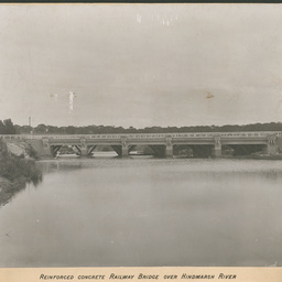
Railway Bridge
Railway Bridge over Hindmarsh River, Victor Harbor.


Hindmarsh Valley Road
Hindmarsh Valley Road, Victor Harbor. Also hold a coloured version of this image as a postcard.


Hindmarsh River
Hindmarsh River, Victor Harbor, the "Adare" is in the background.


Hindmarsh River Bridge
Hindmarsh River Bridge at Victor Harbor.


Hindmarsh River Boat Landing
Hindmarsh River boat landing, Victor Harbor.


Hindmarsh River and Bridge
Hindmarsh River and Bridge, Victor Harbor.


Hindmarsh River
Hindmarsh River, Victor Harbor.


Hindmarsh River, Victor Harbor
Hindmarsh River, Victor Harbor.


Hindmarsh River, Victor Harbor
Hindmarsh River at Victor Harbor.


Hindmarsh River, Victor Harbor
Hindmarsh River, Victor Harbor.


Hindmarsh River, Victor Harbor
Mouth of the Hindmarsh River, Victor Harbor.
