Find • Sweet, Samuel White, 1825-1886 • Results 421 to 450 of 1,125


St. Matthew's, Kensington
St. Matthew's Church, Kensington was established in 1848 after land was donated by the South Australia Company. Many notable early South Australians buried in the grounds include Percy Grainger, Colonel Peter Warburton and Baroness von Oertzen. The photograph shows the church, minus the porch, surrounded by a tall hedge and an archway over the white gates leading to the front of the church.

Harling House, Lower Mitcham
[General description] View of Harling House at Lower Mitcham, taken from the driveway with garden in foreground and hills in the distance. The house was built in 1861 by Charles and Henrietta Everett who lived there until 1873. Charles Everett was a grocer. This view shows three women at the end of the drive leading up to the house. [In the 1920s the building became part of the Salvation Army's Sunset Lodge Nursing Home on the corner of Brenchley Grove and Belair Road, Kingswood. [On back of photograph] 'Mr. W.M. Letchford's [William Martin Letchford (1824-1880)] residence / Lower Mitcham / 1876-77'.

Port Adelaide
Commercial Road, Port Adelaide, looking south from the river. The building on the right is the Customs House which was constructed in 1878-79 to the design of the Colonial Architect George Thomas Light. The South Australian Government collected taxes on goods imported from other Australian states and from overseas. The building has cut stone dressings and cornices and is constructed from Dry Creek stone with dressings of Sydney white freestone. It boosts a prominent tower with a mansard roof, lookout and a flagpole. The tower faces the Port River. On the other side of Commercial Street stands the Commercial Hotel which was built in 1841 and rebuilt after a fire in 1857. JC Addison was the proprietor at the time of this photograph.

Customs House, Port Adelaide
Customs House, Port Adelaide was constructed in 1878 following demolition of the timber customs house which stood on the same spot since 1840. The two storey building was designed in the Victorian Italianate style and constructed from Dry Creek bluestone with Sydney white freestone dressings. It featured a 70 foot high observation tower

Port Adelaide Wharf
The South Australian Company Basin, Port Adelaide Wharf. It was partially reclaimed to create No. 1 Dock in 1934-35. The Colac Hotel can be seen to the right of the bridge. At this time the proprietors were I and J Dyer, 1883-89

Residence at Unley
[General description] This two storey house is in the Georgian style with a conservatory attached to its verandah. It has a neat garden and a white picket fence. Mr.Scammell, pharmaceutical manufacturer was Managing Director of Faulding & Co. for many years. [On back of photograph] 'Residence of Mr. Luther Scammell / Thomas Street, Unley / 1872-86'.

The Brocas, Woodville
[General description] Family members pose at the entrance of 'The Brocas', originally a cottage built circa 1850 by Henry Giles. In 1853 it was bought by well-known Port Adelaide merchant and shipping agent John Newman. This view shows the original cottage is now a mansion being extensively enlarged c. 1870 with the addition of front rooms (ground floor with bay windows), entrance hall and a tower reputedly to the design of architect T. English. Mr Newman, being an old Etonian named his house for Eton's Brocas Meadows. Space in front of the house has been left for an extension to the upstairs balcony which was added in 1873. (See B 10656). [On back of photograph] ''The Brocas' / Woodville / Residence of Mr. John Newman / 1872-73 / Mr. John Newman (Shown in photograph wearing white coat) died in 1873'.

Hindley Street, Adelaide
Hindley Street, north side, showing the Theatre Royal. The billboard in front of the theatre advertises George Musgrove's production of Offenbach's 'La Fille du Tambour Major', starring Nellie Stewart. This production toured Australia in the early 1800s. On the right is the ornate lamp belonging to the White Hart Hotel opposite. The near side of Miller Anderson's (second store from the right) is 41 yards west of Gresham Street. The extreme left of the photograph is 2 yards east of Peel Street. See B 2909 for another view of the Theatre.

Rundle Street
Premises of basketmaker O.E. Tannert, on the south side of Rundle Street. Samples of his work are displayed on the footpath, verandah and roof-top, and include chairs, tables, baskets, trays, bassinets, prams, plant stands and birdcages. The first floor provided accommodation. A researcher has suggested that these items were imported, as most furnishings sold in the Australian colonies were imported. The shop sign is written in German as well as English.

Gover Street, North Adelaide
[General description] The staff of Springett's Grocery store pose for the photographer and a family in a horse drawn cart stand at the kerb. On the opposite side of the street another group poses, including two small girls in white pinafores. Residential housing is seen on either side of Gover Street. [On back of photograph] 'Acres 877, 878, 906 / Gover Street, looking west from O'Connell Street / 1872-78 / South side of Gover Street (on left): The far end of the wall adjoining Springett's store is 62 yards west of O'Connell Street / North side of O'Connell Street (on right): The near side of the brick two storey building (with two chimneys) abuts the western alignment of Fenchurch Street'.

Adelaide View
View looking south-east over Adelaide, from a vantage point on the Treasury Building on the corner of King William and Flinders Streets. St. Francis Xavier's Cathedral (city acre 338) can be seen on the right, with the Prince of Wales Hotel in Angas Street beyond that; to the left along Wakefield Street is the back of the Unitarian Church (with a square tower, city acre 302) and across the street is St. Andrew's Presbyterian Church (city acre 340). In the left foreground in Flinders Street are premises of a cooperage business and T. Hill's billiard, cabinet maker, upholsterer and undertaker building. The Halifax Street brickworks chimney can be seen in the middle ground, with the Adelaide Hills in the distance. The photo is signed in the bottom right corner: 'Adelaide 1865 / Frances Photo'.

North Adelaide
View of North Adelaide looking south from the north side of Stanley Street. The right side of single storey cottage in the foreground is 44 yards west of New Street (cottage frontage is 19 yards). Trees growing in the parklands can be seen in the distance with the Adelaide Hills beyond.

Adelaide, looking South East
View of Adelaide, looking South East from Montefiore Hill in North Adelaide. Factory chimneys and the railway yards can be seen in the foreground beyond the River Torrens. The Town Hall and Post Office towers are visible with the Adelaide Hills in the distance.[On back of photograph] Adelaide, looking south east from Montefiore Hill. Probably in the eighteen eighties.

Botanic Gardens
Botanic Gardens showing nearby buildings and a young man looking at the lake. Young palms have been planted on the grass and the lake is surrounded by two small fences. A tall white building with a statue outside can be seen to the right of the photograph.

Botanic Gardens
Botanic Gardens showing members of the Ladies Boating Club season 1895-96. Photographed on the south bank of the Torrens, east of the Morphett Street Bridge. The ladies are wearing a uniform consisting of straw boater hats with hatbands, white blouses, neck ties, long skirts and are sitting in the reeds on the bank of the River Torrens. They are holding two club flags.

North Terrace
[General description] Loking west along North Terrace with city buildings, horse drawn carts and street trees on the left. The Wills building is in the centre; the Adelaide Club is the two storey building in the distance. On the right is the South Australian Institute building, seen behind the neat white fencing (wrought iron?) and gardens which run along the right side of North Terrace. [On back of photograph] 'Acres 20, 21 / North Terrace East / looking west from a point a little west of Charles Street / 1873-78 / (Wills building and later additions to it)'.

North Terrace, Adelaide
[General description] Looking along North Terrace east with houses and commercial premises on the right and the South Australian Institute building on the left side of the road which is lined with trees and white picket fencing. The spire of Scots Church is seen in the distance. [On back of photograph] 'Acres 20,21 / North Terrace East / Looking east from a point a little west of Kintore Avenue / 1878- 1884 / The near side of G. & R. Wills' premises (on right) is 63 yards east of Gawler Place'.

Victoria Square
Eastern side of Victoria Square seen from the top of the Treasury Building. King William Street divides the two sides of the square. Wakefield Street divides the garden into halves which are fenced with iron pailings and contain benches and shrubs. The Law Courts and Supreme Court Buildings can be seen at the southern end of the square and the Torrens Building is on the eastern side.

Victoria Park Racecourse
Victoria Park Racecourse was the first official race track in South Austrarlia. Races were run here since 1846. The Grandstand, built in 1882 shows quality in its design and construction. It is a two storey bluestone building with red brick dressings, timber and cast iron detailing and ornate staircases. A white picket fence lines the race track. A few chimneys can be seen in the background but mainly the undeveloped grassy plains stretch up towards the hills.

The 'Arabella' loading wool at Ninety Mile Beach
The iron barque 'Arabella', 700 tons, loading wool at Ninety Mile Beach, Western Australia [iron barque, 688 gross (upon sale foreign became 700) ON62880, 177.6 x 31.0 x 17.4. Built 1876 (2). Bartram, Haswell and Co. Sunderland. Owners: TE Hick, registered Scarborough. c. 1895 Trinder Anderson and Co. Ltd. c. 1901/2 to Swedish owners without change of name. While the property of Trinder Anderson was well known in the UK-Western Australia trade. This photograph shows the stern view of the 'Arabella'] She is beached and a team of oxen are pulling wool bales to be loaded on to the ship before high tide.

Victoria Square and King William Street, Adelaide
King William Street, Adelaide and the eastern part of Victoria Square looking south, from a view taken from the roof of the old Treasury Buildings in Flinders Street. The old Supreme Court and Local and Insolvency Court buildings can be seen at the south end of the square.

View of Adelaide
View looking south-east over Adelaide, from a vantage point on the Treasury Building on the corner of King William and Flinders Streets. St. Francis Xavier's Cathedral (city acre 338) can be seen on the right, with the Prince of Wales Hotel in Angas Street beyond that; to the left along Wakefield Street is the back of the Unitarian Church (with a square tower, city acre 302) and across the street is St. Andrew's Presbyterian Church (city acre 340). In the left foreground in Flinders Street are premises of a cooperage business and T. Hill's billiard, cabinet maker, upholsterer and undertaker building. The Halifax Street brickworks chimney can be seen in the middle ground, with the Adelaide Hills in the distance. The photo is signed in the bottom right corner: 'Adelaide 1865 / Frances Photo'.

View over part of Adelaide
View looking south-east over Adelaide, from a vantage point on the Treasury Building on the corner of King William and Flinders Streets. St. Francis Xavier's Cathedral (city acre 338) can be seen on the right, with the Prince of Wales Hotel in Angas Street beyond that; to the left along Wakefield Street is the back of the Unitarian Church (with a square tower, city acre 302) and across the street is St. Andrew's Presbyterian Church (city acre 340). In the left foreground in Flinders Street are premises of a cooperage business and T. Hill's billiard, cabinet maker, upholsterer and undertaker building. The Halifax Street brickworks chimney can be seen in the middle ground, with the Adelaide Hills in the distance. The photo is signed in the bottom right corner: 'Adelaide 1865 / Frances Photo'.
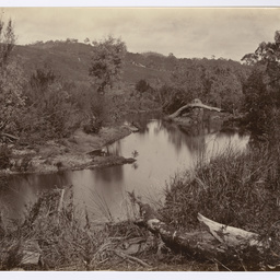
Creeks and rivers in South Australia
Nine views featuring various creeks and rivers in South Australia, including the Torrens River.

Baptist Chapel, Angaston
Angaston Baptist Chapel taken during 1883-1885, now used as the Zion Lutheran Church (1945).

Aroona Water
Windy Creek at Aroona Water, 25 miles north west of Beltana. There are camels at the edge of the creek and a towering rock formation stands in the background.

Auldana Homestead
Auldana homestead built in 1852 by Patrick Auld and occupied by the family until 1888. Mr. & Mrs. P. Auld on the left of the picture were parents of William Patrick Auld who crossed the Continent with John McDouall Stuart in 1861-2.

"Sunnyside", Beaumont
[General description] 'Sunnyside', set amongst extensive gardens is an impressive symmetrical bluestone house with square bay windows at either end and a central gabled verandah over its entrance. The original small house was built on a forty acre estate in the 1840s but was improved and significantly enlarged by new owner (Sir) William Milne who purchased the property in 1850. [On back of photograph] 'Sunnyside', Beaumont / 1872- 86 / Residence of Sir William Milne'.

Inebriates' Retreat, Belair
[General description] This imposing two storey stone building, with its twin gables and decorative iron and brickwork, was built in 1881 as an Inebriates Retreat by Daniel Hewett. It was further extended in 1898. Between 1893-1907 it became Hope Lodge for the training of Missionaries. Since 1998 it has beome part of St. John's Grammar School. [On back of photograph] 'Inebriate's Retreat, Belair. / 1883-86'.

Belair Railway Station
Belair railway station opened in 1883 with the opening of the Adelaide to Aldgate section of the Adelaide to Melbourne line. A large wooden shelter was built for the crowds who used the train to visit the nearby National Park