Find • murray • Results 571 to 600 of 5,749


The bridge at Murray Bridge
Distant view of the bridge over the Murray River at Murray Bridge, South Australia.


Paddle steamer at Murray Bridge
The paddle steamer 'Murrumbidgee', right, towing two barges, the 'Achilles' and 'Ajax' as they pass below the bridge at Murray Bridge, South Australia.


Pumping machinery sending water from an irrigation channel into the Murray River at Murray Bridge
Pumping machinery sending water from an irrigation channel into the Murray River at Murray Bridge.


Panoramic view of part of the Murray River and surrounding country near Murray Bridge
Panoramic view of part of tfhe Murray River and surrounding country near Murray Bridge.

![[Map showing sections in]County of Russell, Hundred of the Murray [cartographic material]](https://slsa-collections.s3.amazonaws.com/11/75/624a-f6fa-5e87-b6a0-194e478800a3.jpg)
[Map showing sections in]County of Russell, Hundred of the Murray [cartographic material]
Tracing of map showing sections in the Hundred of Murray, around the edge of 'Lake Albert Peninsula'. Points Malcolm and McLeay are shown. Except for section 326 (north of Reedy Point), all of the eastern, northern and north western side section numbers were renumbered. (Those near Loveday Bay, on the south western side of the Peninsula, still use the numbers on this map.) Ink and watercolour on paper, ink notation. Scale 2 inches to 1 mile.


Murray Bridge Works
Murray Bridge works, showing the bridge under construction. The mount details the depth of cylinders from underside of main girders [also at B 18642].


Murray Bridge railway bridge
Railway bridge at Murray Bridge viewed from the river.


The 'Gem' and 'Marion' at Murray Bridge
The 'Gem' and 'Marion' moored side by side at Murray Bridge. Reproduced as a postcard, the caption on the back reads 'Friendly competitors. By the 1930s the few remaining river boats catered mainly for the tourist trade. Cruises would be arranged between such places as Renmark and Goolwa with calls at towns along the way. Friendly rivalism between skippers would somtimes result in a race down river with each crew trying to outdo the other. Here the 'Gem' and the 'Marion' are moored side by side at Murray Bridge. Photo: Swan Hill Pioneer Museum'. This photo is part of the Sheahan Collection which consists of 114 views depicting river craft and two steam boat captains, bridges, and locks on the Murray River in South Australia.


The 'Murray River Queen'
A researcher suggests that this is the P.S. Gem which was sometimes referred to as Queen of the Murray, possibly a shortened version of "Queen of the Murray Shipping fleet". Paddle steamer moored at the bank, with another paddle steamer beside it. This photo is part of the Sheahan Collection which consists of 114 views depicting river craft and two steam boat captains, bridges, and locks on the Murray River in South Australia.


Cooking dinner in style on the banks of the Murray
Ellen Saunders preparing a picnic near her Ford station wagon, on the Murray River. "Cooking dinner in style on the banks of the Murray, we pack everything but the kitchen sink into the car."


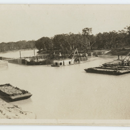
Barges at lock 2, Murray River
Digital copy of a sepia photograph of barges in the 'middle dam at lock 2'. An inscription on the verso reads 'G. Bonsor'; image possibly taken by George.


Paddle steamer at lock 2, Murray River
Digital copy of a black and white photograph of a 'paddle steamer at lock 2'. A researcher suggests that this is the P.S. Pevensey. An inscription on the verso reads 'G. Bonsor'; image possibly taken by George. Another researcher indicates that this is more likely lock 9 as lock 2 is on the opposite side of the river.


Lock chamber in construction, lock 4, Murray River
Digital copy of a black and white photograph of the lock chamber of lock 4 in construction. An inscription on the verso reads 'G. Bonsor'; image possibly taken by George.


Flying fox at lock 9, Murray River
Digital copy of a sepia photograph of sheds, materials, and the 'Flying Fox tower at Lock 9, driven by Bill Bonsor'. An inscription on the verso reads 'G. Bonsor'; image possibly taken by George.


Jean and Fred Murray at 'Kalinya', Mount Barker
Digital copy of a black and white photograph of Fred and Jean Murray (nee Bottroff), parents of Violet Edith Frost, standing on the Eastern side of the Frost family's house on the farm, 'Kalinya'.

![[Early settlers, Port Lincoln and Western Districts - series 4] : George Wright Murray](https://slsa-collections.s3.amazonaws.com/25/7f/5dbd-d0b0-5590-83e0-54e3a2d0eee8.jpg)
[Early settlers, Port Lincoln and Western Districts - series 4] : George Wright Murray
George Wright Murray, 1851-1933. Born at Adelaide, South Australia to Jane Murray, nee Wright, and William Murray. Manager, Fowlers Bay station; pastoralist, Yalata station.


River Accident
An accident at Kingston-on-Murray, 10 August 1962. A load has slipped off a vehicle while being loaded onto the ferry. Originally named Thurk, the township was renamed Kingston on Murray in 1940


Replacing Punt Approach
Kingston on Murray: replacement of punt approaches after floods.


Replacing Punt Approach
Kingston on Murray: replacement of punt approaches after floods.


Fruit Packing Shed
Kingston on Murray: fruit packing shed surrounded by flood water.


Flooded Vineyard
Kingston on Murray: vines during the beginning of floods.


Flooded Vineyard
Kingston on Murray: vines during the beginning of floods.


Carting Sand for Floods
Kingston on Murray: carting sand for sand Banks during floods.


Pumping Station during Flood
Kingston on Murray: Kingston pumping station during flood.


Floods, Kingston On Murray
Damage caused to the fruit packing shed by flood.


Floods, Kingston On Murray
Sand bags surrounding a house during the flood.


Floods, Kingston On Murray
Flood waters surrounding houses.


Floods, Kingston-on-Murray
Damage caused to the fruit packing shed.


Floods, Kingston-on-Murray
Flood waters surrounding a house.


Floods, Kingston-on-Murray
Sand bank construction during floods.
