Find • adelaide aerial • Results 151 to 180 of 653


Aerial photographs of the city of Alexandrina: Goolwa Beach
Aerial views of Goolwa Beach, in the city of Alexandrina, South Australia. See below for details.

Aerial photographs of the city of Alexandrina: Hayborough
Aerial views of the suburb of Hayborough, Victor Harbor, in the city of Alexandrina, South Australia. See below for details.

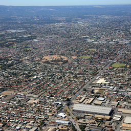
Aerial photographs of the town of Gawler
Aerial views of the town of Gawler, South Australia. See below for details.

Aerial photographs of Alexandrina: Hindmarsh Island and the Murray Mouth
Aerial views of the south-east corner of Hindmarsh Island and the Mouth of the Murray River, in Alexandrina Council, South Australia. See below for details.

Aerial photographs of the city of Holdfast Bay: Glenelg South
Aerial views of Glenelg South, in the city of Holdfast Bay, South Australia. See below for details.

Aerial photographs of the city of Holdfast Bay: North Brighton
Aerial views of North Brighton, in the city of Holdfast Bay, South Australia. See below for details.

Series 046: Aerial views of Emu Wines, Morphett Vale
Aerial views of the buildings and surrounding vineyards of Emu Wines at Morphett Vale. The Adelaide to Willunga railway line, States Road, Doctors Road, Huntingdale Creek and Wheatsheaf Road are visible in some of the images.

Aerial photographs of the city of Charles Sturt: Cheltenham
Aerial views of Cheltenham, in the city of Charles Sturt, South Australia. See below for details.

Series 105: Aerial views of country towns
Aerial views of country towns and locations around South Australia including Birdwood, Murray Bridge, Mannum, Tailem Bend, Gumeracha, Athelstone, Berri, Strathalbyn, and Palmer.

Aerial photographs of the town of Gawler: Gawler East
Aerial views of Gawler East, in the town of Gawler, South Australia. See below for details.

Aerial photographs of the city of Charles Sturt: Woodville West
Aerial views of Woodville West, in the city of Charles Sturt, South Australia. See below for details.

Aerial photographs of the town of Gawler: Reid
Aerial views of Reid, in the town of Gawler, South Australia. See below for details.

Aerial photographs of the town of Gawler: Evanston Park
Aerial views of Evanston Park, in the town of Gawler, South Australia. See below for details.

Aerial photographs of the town of Gawler: Evanston South
Aerial views of Evanston South, in the town of Gawler, South Australia. See below for details.

Aerial photographs of the city of Holdfast Bay: Hove
Aerial views of Hove, in the city of Holdfast Bay, South Australia. See below for details.

Aerial photographs of the Imperial Chemical Industries (ICI) Australia salt fields
34 black and white photographs documenting the building of the Imperial Chemical Industries (ICI) Australia at Dry Creek, South Australia. The photographs were created or collected by Wilfred Grant Webster, as part of the role as manager of conservation and safety at ICI Australia. See also State Library of SA Oral History collection item OH 233, 'Interview with Wilfred Grant Webster' by Tony Evans and B 74347/1-106.

Series 049b: Aerial views of Adelaide and Prospect
Aerial photographs of Adelaide city and the northern suburbs including Prospect, taken on small format acetate negatives.

Series 087a: Aerial photographs of General Motors at Birkenhead
Aerial photographs of the General Motors factory at Birkenhead, and views of the surrounding houses of Birkenhead and shipping in the Port River.
Aerial photographs of the city of Charles Sturt: Pennington
Aerial views of Pennington, in the city of Charles Sturt, South Australia. See below for details.

Aerial photographs of the city of Charles Sturt: Hendon
Aerial views of Hendon, in the city of Charles Sturt, South Australia. See below for details.

Aerial photographs of the town of Gawler: Gawler West
Aerial views of Gawler West, in the town of Gawler, South Australia. See below for details.

Aerial photographs of the town of Gawler: Evanston
Aerial views of Evanston, in the town of Gawler, South Australia. See below for details.

Series 009a: Aerial views of Parafield and Outer Harbor
Aerial views of Parafield Airport, aeroplanes, and Outer Harbor.

Series 018: Aerial views of Emu Wines
Aerial view of Emu Wines at Morphett Vale, adjacent to the Adelaide to Willunga Railway. States Road and Huntingdale Creek are visible in one image.

Aerial photographs of the town of Gawler: Willaston
Aerial views of Willaston, in the town of Gawler, South Australia. See below for details.

Series 043: Assorted aerial views
Aerial views of industrial buildings comprising G.H. Michell and Sons Ltd at Hindmarsh, the Shell fuel storage facility and Motteram Biscuit factor near West Terrace, Adelaide, and the abattoirs at Pooraka.

Aerial photographs of the town of Gawler: Kudla
Aerial views of Kudla, in the town of Gawler, South Australia. See below for details.

Series 013a: People and places relating to the Catholic Church in Adelaide
Aerial images of Goodwood Orphanage and the Passionist Monastery, Glen Osmond. Photographic portraits af Roman Catholic Archbishop Robert William Spence (1860-1934).

Aerial photographs of the city of Port Adelaide Enfield : Semaphore South
Aerial views of Semaphore South, in the city of Port Adelaide Enfield, South Australia, including views of the Point Malcolm Reserve, Glanville Hall Golf Course, EP Nazar Reserve, the Port Adelaide District Hockey Club and Lion Soccer Club, and the foreshore.

Series 012: Roman Catholic Eucharistic Congress Celebration at the Jubilee Oval
The 1928 Eucharistic Congress Celebration at the Jubilee Oval, corner of Frome Road and Victoria Drive. Photographs taken from the air from various directions. The international Eucharistic Congress was held in Sydney, and this event was the local Adelaide celebration. The Jubilee Oval hosted large sporting and other events, including the Royal Agricultural and Horticultural Society Shows. It was operational from 1895-1945. University of Adelaide buildings and the Exhibition Building can be seen in some of the images.