Recently Viewed


SS Sorata
SS Sorata at Cape Jervis.


St. John's Church, Halifax Street, Adelaide
Looking diagonally across Halifax Street towards the front porch of Saint John The Evangelist Anglican Church (Church of England).


Gundalabbie shed and tanks on the Nullarbor Plains
NULLARBOR PLAINS: Caravan and car parked near the remains of the Gundalabbie shed and tanks, 2 October 1958.


The Settler's Club, Mildura, Victoria
The Settler's Clubrooms, Mildura, Victoria.


Actor wearing stage costume
GENERAL: An actor wearing a tennis stage costume for the Johnston Revue.


Wilpena Pound Range
Wilpena Pound Range from Malerina Creek.


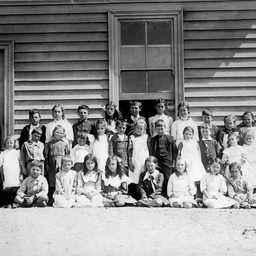
Pupils outside Iron Knob school, South Australia
Pupils and their male teacher outside the premises of Iron Knob school in South Australia.


Storekeepers, Point Pass
Studio view of Mr. & Mrs. C. F. Leditschke, Store-keepers at Point Pass.


Berri Orchards
Berri Orchards in the Irrigation area.


North Terrace West
North Terrace West, South side. 17 August 1939. The third storey was added to this building in 1938. Compare with B 2259. The right side of the three storey building abuts Victoria Street. Frontage: 31 1/2 yards. The Grosvenor Hotel can be seen to the left of the photograph. This name was adopted in 1920. Previous names include City Temperance, Federal Coffee Palace, Grayson's Coffee Palace. The name "The News" is set in stone on the third storey. The News was Adelaide's afternoon newspaper which was established in 1869.


Old Home, Mount Gambier
Old Home, Mount Gambier.


Post Office, Laura
Post Office at Laura.


Races
Photograph of a winning horse and jockey being congratulated by the owner and an official at the Race Course on 28th December 1961, Mount Gambier.


Uraidla Hospital
[General description] Sandstone building housing the Uraidla Hospital. The hospital has a return verandah with cane chairs for recuperating. Palm trees are planted in the garden. [On the back of photograph] Uraidla Hospital. Recently opened Oct. 1925. Reproduced in the Observer, Oct. 31, 1925.


Caterpillar Tractor
A Caterpillar tractor works on the final stage in the preparation of the sub-base of the road during construction on the Nullarbor Plains.


Railway Station, Jamestown
Jamestown Railway Station.


Mount Mary Hotel
[General description] There are two bullock teams standing in front of the Mount Mary Hotel, situated in saltbush desert country near Morgan. One of the wagons is loaded with grain bags.


Church Foundation Stone
A. T. Ballantine laying a church foundation stone.


The hospital at Tarcoola
TARCOOLA: Distant view of a tin shed serving as the hospital at Tarcoola in the north west of South Australia.


Richmond Heavy Towing Ford Louisville Tilt Tray tow truck
Richmond Heavy Towing Ford Louisville Tilt Tray tow truck, fleet number 8. On the tray is a Ford F350 tow truck fleet number 2.


Cricket Match, Nullarbor
Cricket match between men of the two road construction camps on the Nullarbor Plains : Crawford's & McMahon's. The match was held on the Crawford's Camp air-strip, 40 miles east of the border between South and Western Australia.


Barkuma, Elizabeth
View of 'Barkuma, Central Districts' office in Elizabeth. Originally established as a locally based community service in Elizabeth in 1964 and Incorporated as Central District Mentally Handicapped Children's Association. The Association's name was changed to Barkuma, an Aboriginal word meaning 'aid' in 1980. The Association provides a range of support for people with disability including finding employment, learning skills, and becoming part of the community.


Brewery Bridge, Clare
Brewery Bridge.


'Viking' 4 masted barque
4 masted barque 'Viking' running before a strond breeze [steel 4 mast barque, 2952 gross, 2541 net tons. 293.8 x 45.9 x 23.8. Built 1907 (6) Burmeister and Wain, Copenhagen. Danish sail training ship, registered Copenhagen. Still in existence at Gothenburg, used as hostel etc.]


Raymond and Moni Pimlott
Raymond and Moni Pimlott with their pet dog Jacko.


A.J. Byrne
Photograph of A.J. Byrne in army uniform. According to a researcher, this is Private BYRNE, Albert John service number SX19874. Born Mount Gambier, 1922.


Lange & Co. Mount Gambier
Staff of Lange & Co., Mt. Gambier.


Franklin Street
Franklin Street, north side, December 11th 1924, frontage of the building on the left is 13.5 yards.


"Corryton Park" Mt Crawford
Avenue to Corryton Park (Mount Crawford now.).


Whyalla
View of Whyalla and Broken Hill Proprietary Works. The railway line travelling through the town can be seen and the expanse of bush in the background behind.
